
Floodplain
Floodplain, floodway and flood insurance information for Saugatuck property owners.

Frequently asked questions
What is a floodplain?
The low land next to a river or lake that is covered by water during a flood.
What is the floodway?
The channel of a river and the adjacent land that must stay open to carry flood waters without raising flood heights.
What is a 100-year flood?
A flood that has a 1-percent chance of happening in any year. Over a 30-year mortgage, that is a 26 percent chance.
What is the 100-year floodplain?
The area FEMA maps as the Special Flood Hazard Area, the land covered by a 100-year flood.
What is the NFIP?
The National Flood Insurance Program, which makes federally backed flood insurance available in participating communities.
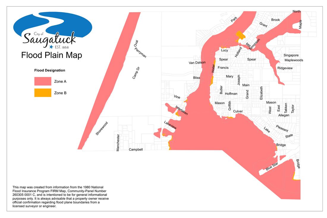
Floodplain map
Contact
The Zoning Administrator at City Hall, (269) 857-2603.
Questions? Call City Hall at (269) 857-2603 or send a message.